Current Conditions
♦
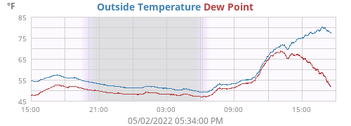
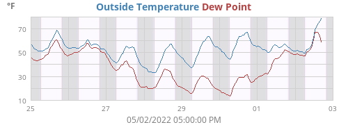
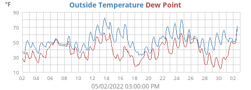
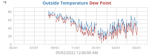
| Outside Temperature | 77.6°F |
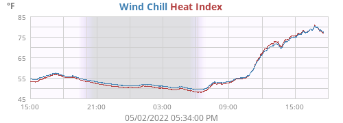
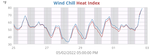
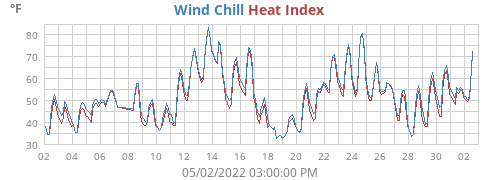
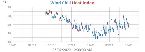
| Heat Index | 77.0°F |
| Wind Chill | 77.6°F |
| Dew Point | 52.0°F |
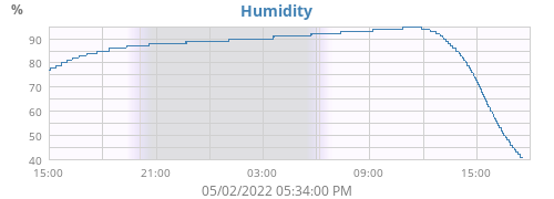
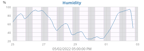
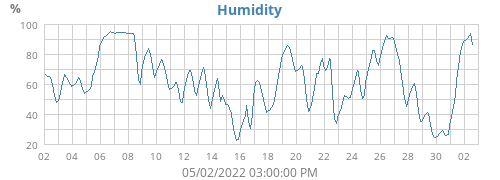
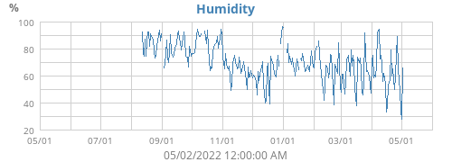
| Humidity | 41% |
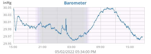
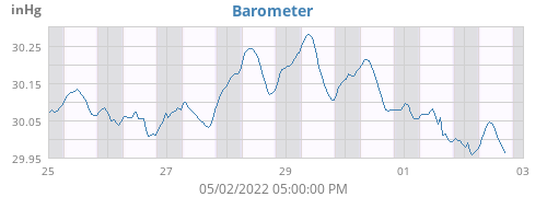
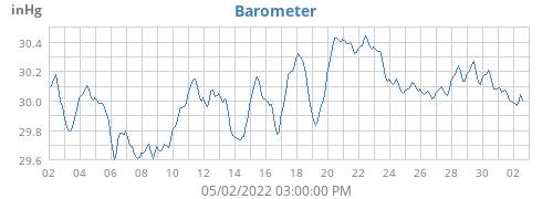
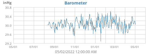
| Barometer | 29.968 inHg (-0.028) |
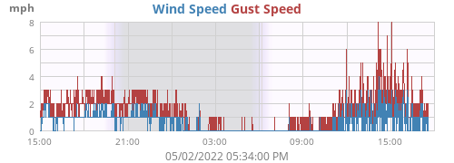
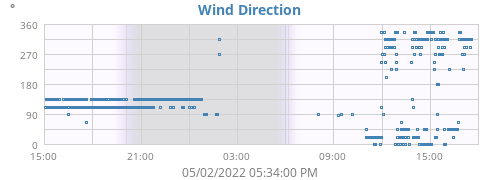
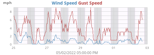
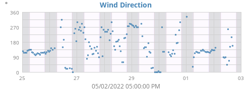
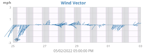
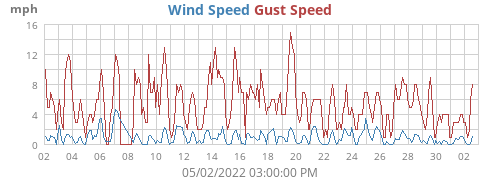
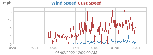
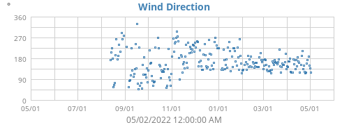
| Wind | 0 mph N/A ( N/A) |
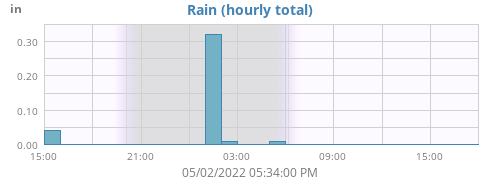
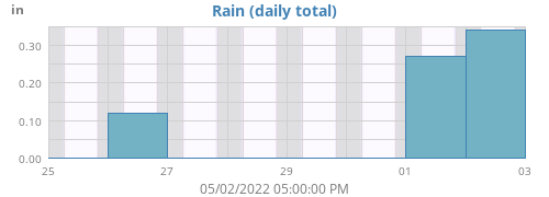
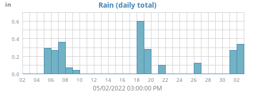
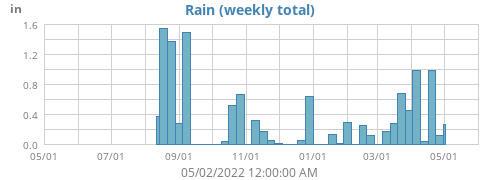
| Rain Rate | 0.00 in/h |
| Rain Today | 0.34 in |
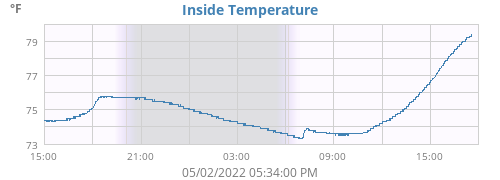
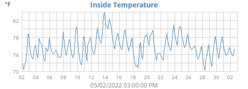
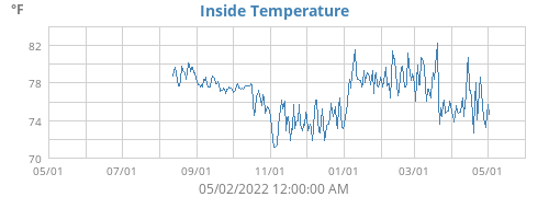
| Inside Temperature | 79.4°F |
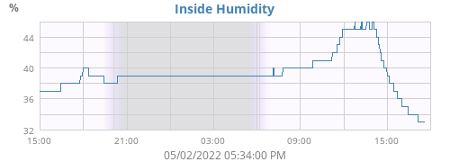
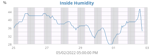
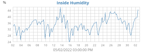
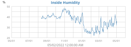
| Inside Humidity | 33% |
| Today |
Week |
Month |
Year |
Rain Year |
||
|---|---|---|---|---|---|---|
| Outside Temperature |
80.3 49.2 |
80.3 49.2 |
80.3 49.2 |
84.0 7.8 |
84.0 7.8 |
°F |
| Heat Index | 80.9 | 80.9 | 80.9 | 85.8 | 85.8 | °F |
| Wind Chill | 49.2 | 49.2 | 49.2 | 4.3 | 4.3 | °F |
| Dew Point |
69.0 47.0 |
69.0 28.5 |
69.0 28.5 |
69.0 0.1 |
69.0 0.1 |
°F |
| Humidity |
95 41 |
95 36 |
95 36 |
96 22 |
96 22 |
% |
| Barometer |
30.050 29.958 |
30.117 29.958 |
30.117 29.958 |
30.708 29.093 |
30.708 29.093 |
inHg |
| Rain | 0.34 | 0.61 | 0.61 | 5.14 | 5.14 | in |
| Rain Rate | 6.33 | 6.33 | 6.33 | 655.35 | 655.35 | in/h |
| Wind Max |
8 321 |
8 321 |
8 321 |
17 22 |
17 22 |
mph ° |
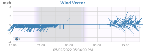
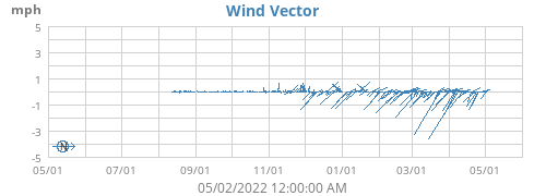
| Wind Average | 0 | 1 | 1 | 1 | 1 | mph |
| Wind RMS | 1 | 1 | 1 | 2 | 2 | mph |
|
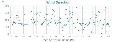
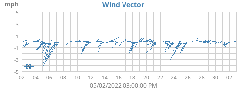
Vector Average Average Direction |
0 353 |
0 109 |
0 109 |
0 99 |
0 99 |
mph ° |
| Inside Temperature |
79.4 73.3 |
79.4 73.3 |
79.4 73.3 |
84.3 69.6 |
84.3 69.6 |
°F |
| Inside Humidity |
46 33 |
46 30 |
46 30 |
47 17 |
47 17 |
% |
| Connectivity | |
|---|---|
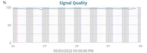
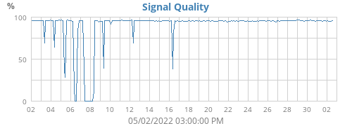
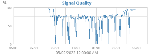
| Signal Quality | 94% |
| Battery Status | |
| Transmitter Battery | OK |
| Voltage | |
| Console Battery | 1.3 V |
About this weather station
♦
| Hardware | Vantage Vue |
| Latitude | 39° 24.81' N |
| Longitude | 077° 40.73' W |
| Altitude | 1024 feet |
| Server uptime | 44 days, 0 hours, 49 minutes |
| WeeWX uptime | 44 days, 0 hours, 26 minutes |
| WeeWX version | 4.5.1 |